 The intent of the Water Conservation and Quality Improvement grant program is to assist local governments in addressing issues that enhance valley-wide sustainable use of water. Projects were selected for recommendation based on a range of factors – including how well the project matched the goals of the program, the availability of funding, and whether the project supports other regional initiatives such as the Okanagan Basin Water Supply and Demand Study and OBWB policy recommendations.
Scroll down, or click on the links below to view recipients, listed by each regional district:
- Regional District of North Okanagan
- Regional District of Central Okanagan
- Regional District of Okanagan-Similkameen
Download the Summary (180Kb PDF)
Regional District of North Okanagan
Larkin Waterworks District
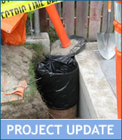
Groundwater Protection Measures: Well Casing and Raising
Two wells in the Larkin Waterworks District are undergoing improvements for better well protection as per Interior Health Authority and recommendations from Golder Associates Inc. Larkin Waterworks is undertaking installation of routine water level recording instruments and well raising and casing (above ground) installations to comply with wellhead protection requirements. This is a solid first step in Groundwater Protection Planning and contributes information to the Groundwater Assessment of the Okanagan Basin.
Regional District North Okanagan
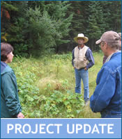
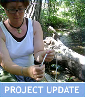
Sensitive Habitat Inventory Mapping (SHIM) – Rural Vernon Creeks
This SHIM project collects data on the health of riparian areas, fisheries values, human modifications, water intakes, storm water outfalls, erosion and other water quality concerns for creeks in the rural Vernon OCP area. Projects that contribute data to large regional efforts are a priority for this grant program and this project complements and extends work already done in the North Okanagan. The data is used by planners at the Regional District; especially as existing stream maps are not highly accurate.
City of Vernon
Low Flow Toilet Rebate Program
This project is furthering the City of Vernon’s ongoing toilet rebate program in order to reduce domestic water consumption and load on the wastewater treatment facility. Toilet rebate programs are a tangible water conservation measure that can increase awareness of other measures for water conservation.
Okanagan Collaborative Conservation Program (OCCP)
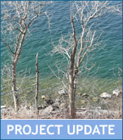
Foreshore Inventory Mapping – Okanagan Lake North
The OCCP is GPS mapping shoreline to inventory the ecosystem characteristics, and filming fly-over video footage. This project is a very strong partnership as the participants in the cooperative are able to use resources and methodology previously developed by other agencies in addition to receiving in-kind resources to carry out this project. This project adds to information already collected and picks up where other efforts left off, thus completing more basin wide data. Results are very useful for local government planners.
Greater Vernon Water Utility
Duteau Watershed Cattle Impact Reduction Plan
This project is a portion of the larger Source Water Protection Planning initiatives for Duteau Creek and is GPS mapping fencing, cattle access points to streams, gates and cattle guards. Once the inventory of structures is complete, a monitoring, maintenance and work plan is formed to reduce contamination risks to the water supply. GVS has full cooperation with the ranchers in the area who will be involved in creating the maintenance plan for the structures.
Download the Duteau Watershed Cattle Impact Reduction Plan (PDF)
Regional District of Central Okanagan
District of Lake Country
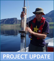
Okanagan Deep Lake Biology Study
This project has taken water samples from 10 Okanagan Lake water intakes in addition to deep lake water samples to analyze for algae and E.coli bacterial amounts. This project is a partnership among water purveyors with intakes on Okanagan Lake and has in-kind contributions from water professionals in the community. This project will improve planning for deep lake intakes and water treatment options of Okanagan Lake water.
Regional District Central Okanagan
Preliminary Hydrogeological Assessment of Joe Rich
This project is conducting preliminary investigation into groundwater aquifers in the Joe Rich area to determine locations where further detailed investigation may be warranted. RDCO may incorporate other resources into this study, including the new “State of the Basin, Groundwater Report” from the Water Supply and Demand Project and additional information on groundwater development compiled by a local consultant on the Joe Rich area.
District of Peachland
Water Master Plan – Implementation, Phase 1
As part of Peachland’s new domestic water meter installation and as a result of the Master Water Plan, the District will establish a new water conservation bylaw including rate structure to promote equitable billing and cost recovery. This project will also examine suitable sites for future water treatment plant (water quality improvements) and expansion of reservoirs (hydrologic assessment). 25% reductions in water consumption for domestic connections is expected in Peachland.
City of Kelowna
Landscape and Irrigation Standards for Water Efficiency
The City of Kelowna has created a draft Landscape and Irrigation Standards bylaw to be implemented after final stakeholder review, development of public education materials and a pilot program to measure impact of the standards on peak demand. This project has been developed in conjunction with the landscape industry and other collaborative efforts. This project can be used as a model for other communities to undertake similar initiatives.
Regional District Central Okanagan
Delineating Kelowna/Wood Lake Buried Valley Using Seismic Reflection
This project is a component of the Groundwater Assessment of the Okanagan Basin (GAOB); completed by researchers from the Geologic Survey of Canada. Results of the seismic data collection include bedrock layer identification and 3D mapping to create a hydrogeological model of the major aquifer systems in the central Okanagan. The model will be used for groundwater resource management and to assess aquifer vulnerability. This project is a large water science initiative within the Okanagan, contributing to the OBWB’s goals of becoming a hub for water science and research.
City of Kelowna
RDCO and City of Kelowna – SHIM Completion Project
This project is the final phase in 6 years of stream mapping to ensure all streams within City and Regional District limits are accurately mapped and inventoried. Information will be shared on the Community Mapping Network so it is available to the public, consultants and other levels of government. This project exhibits solid partnership and will add to basin wide data, two aspects that are given a high priority for this grant program by the Okanagan Basin Water Board.
Kelowna Joint Water Committee
Phase III – Groundwater Protection Planning
This is a continuation of groundwater protection efforts, undertaken by the Kelowna Joint Water Committee, to develop groundwater protection measures, implement these measures and establish contingency and emergency response planning processes. Groundwater Protection Planning is a component of Source Protection Planning, which is a high priority for the Okanagan Basin Water Board.
Glenmore Ellison Improvement District
Upper Mill Creek – Off Channel Watering Study
This project is installing cattle exclusion fencing and establishing off channel watering structures in suitable areas in the upper watershed area of Mill Creek. Staff at GEID has committed to work with Coldstream Ranch and Ministry of Forests and Range to maintain any structures that are constructed over the course of this project.
Oceola Fish and Game Club
Surface/Groundwater Interaction Study – Middle Vernon Creek
Movement and interaction of shallow groundwater flow between Ellison and Wood Lake is being clarified through this study, results of which have impacts on water users, fisheries and ecological flows for Middle Vernon Creek. This project is considered a lead up to a Water Use Plan, to be undertaken in 2009.
Mission Creek Working Group
Sediment Mitigation Strategies for Lower Mission Creek
The Mission Creek Working Group is a multi agency group working to restore large portions of Mission Creek through large projects such as dyke set backs, re-meandering of the river channel and installation of sediment control measures. This sediment mitigation project reduces the need for flood control maintenance and improves kokanee habitat for lower Mission Creek.
Westbank Irrigation District
Source Water Protection Planning

Lakeview Irrigation District
Source Water Protection Planning

Glenmore Ellison Improvement District
Source Water Protection Planning – Mill Creek
South East Kelowna Irrigation District

Source Water Protection Planning – Hydraulic Creek
Four central Okanagan Irrigation/Improvement Districts are undertaking source water protection plans for their respective watershed by completing Modules 1, 2, 7 and 8 of the Drinking Water Source to Tap Assessment Guidelines. Source Protection Planning efforts are being given a high priority by the Okanagan Basin Water Board for this round of funding as the first step for watershed protection. Purveyors are working collectively to develop uniform approaches to source protection planning that can be applied throughout the valley.
Regional District of Okanagan-Similkameen
University of British Columbia – Okanagan
Osoyoos Lake Sediment Core Project
UBC-O researchers are establishing historic water quality information for Osoyoos Lake; using nutrient characteristic information from pre-settlement time will provide for more accurate and achievable nutrient targets to be established for the lake today. This project is in response to the outcomes of the Osoyoos Lake Water Science Forum, where Action #2 in the Summary report specifically asks for historic water quality reconstruction. Core samples taken in Spring 2008 are analyzed for nutrient content and to reconstruct historic water quality; these samples are also reserved for future analysis, particularly pesticides and chemical residues when funding permits (estimate 2009).
Regional District Okanagan Similkameen
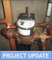
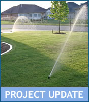
Irrigation Scheduling Naramata Water System
The regional district provided a pilot group of irrigators with equipment and information to schedule irrigation and then compared against a control group without access to equipment as a way of showing how much water can be saved with irrigation scheduling practices in hopes of getting all irrigators to become more efficient. A portion of this project also involves installing water meters on properties who participated in the study – helping to overcome resistance to metering.
Regional District Okanagan Similkameen
Park Rill Restoration and Stewardship Project
RDOS in partnership with Ducks Unlimited Canada, the South Okanagan Similkameen Stewardship Program and the Friends of Park Rill are undertaking stream restoration work in order to begin rehabilitation of this area. Education and outreach complements this program in order that restoration efforts can be maintained and enhanced.
Regional District Okanagan Similkameen
Skaha Lake Shoreline Study
RDOS is completing foreshore inventory mapping for Skaha Lake, using the Foreshore Inventory Mapping methodology and tools previously developed throughout the province. This is also the same technique used for the North Okanagan foreshore mapping project. This project contributes data to a large regional initiative and enhances foreshore planning and development to incorporate ecologically sensitive areas. This project is an excellent partnership as it utilizes resources in the valley already developed.
District of Summerland
Sensitive Habitat Inventory Mapping (SHIM)
District of Summerland is completing SHIM on priority watercourses in the municipality, in order to better assist planning staff with guidance on environmental management decisions. This is the first SHIM project for Summerland. Projects that contribute data to large regional projects are given high priority for this grant program. SHIM has been completed extensively in the Central Okanagan Regional District, in addition to areas in RDOS and the North Okanagan, thus efforts in Summerland will complement and build upon this information.
District of Summerland
Fencing at Thirsk Lake Reservoir to Improve Water Quality
Thirsk Lake is a primary reservoir for the District of Summerland water supply where cattle access and recreation activities are threatening water quality and increasing the potential for nutrient loading and introduction of bacterial contamination. This fencing project creates a barrier for both cattle and recreational users with a maintenance plan to be carried out by the Ministry of Forest and Range.
City of Penticton
Ellis Creek Irrigation System Flow Measurement
This project complements the work completed in the summer of 2007 which installed hydrometric monitoring equipment on the lower reaches of Ellis Creek and the 2006 installation of flow monitoring on Penticton Creek. Hydrometric monitoring is of a high priority to the OBWB and contributes to the Water Supply and Demand Project.
Osoyoos Oxbows Restoration Society
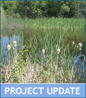
Rewatering of Quintal and Winters Oxbows
This project is re-watering Winters and Quintal Oxbows through the Summer of 2008 in order to assess the impacts to water quality for water entering Osoyoos Lake. By incorporating the oxbows in the current flow pattern, the Osoyoos Oxbow Restoration Society believes that water quality will improve, so the Oxbows Restoration Society is providing updates on water quality parameters to interested agencies with continuous data collection occurring throughout the trial period.