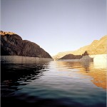
Lake Mead, the vast reservoir for the Colorado River water that sustains the fast-growing cities of Phoenix and Las Vegas, could lose water faster than previously thought and run dry within 13 years, according to a new study by scientists at the Scripps Institution of Oceanography.
The lake, located in Nevada and Arizona, has a 50 percent chance of becoming unusable by 2021, the scientists say, if the demand for water remains unchanged and if human-induced climate change follows climate scientists’ moderate forecasts, resulting in a reduction in average river flows.
Demand for Colorado River water already slightly exceeds the average annual supply when high levels of evaporation are taken into account, the researchers, Tim P. Barnett and David W. Pierce, point out. Despite an abundant snowfall in Colorado this year, scientists project that snowpacks and their runoffs will continue to dwindle. If they do, the system for delivering water across the Southwest would become increasingly unstable.
“We were really sort of stunned,” Professor Barnett said in an interview. “We didn’t expect such a big problem basically right on our front doorstep. We thought there’d be more time.”
He added, “You think of what the implications are, and it’s pretty scary.”
The two researchers used data on river flows and reservoir levels from the federal Bureau of Reclamation, the agency that manages the lower Colorado River and the reservoirs of Lake Mead and Lake Powell. Terry Fulp, manager of the bureau office for the lower Colorado River, said he disagreed with the paper’s assumption that global climate models were sensitive or refined enough to forecast regional effects.
Other recent research has shown that the watershed feeding the Colorado River has historically had a tendency to be far drier than it has been in the past century. The new study projects that changes foreseen in a warming world could well help tip the region back into its dry norm. The river, at the same time, is essentially oversubscribed.
Colorado River water was apportioned among seven Western states in 1922 based on river flow levels that have since proved to be unusually high. Last fall, federal officials reached an agreement with California, Arizona and Nevada — the three states that share the lower Colorado River flow — on how to allocate water if the river runs short.
The agreement, including measures to encourage conservation, was expected to forestall litigation among various claimants for the water. It was based on an assumption that the current flow measured at Lee’s Ferry, just south of Lake Powell, could fall short of demand by as much as 500,000 acre-feet a year. The two reservoirs last year were at about 50 percent of capacity.
The Scripps study indicates that the odds are that the shortfall will exceed 500,000 acre-feet a year long before 2026, when the new agreement runs out. The study has been accepted for publication in Water Resources Research, a journal of the American Geophysical Union.
Pat Mulroy, the general manager of the Southern Nevada Water Authority, said that she had not read the study but that the agreement the states and federal government reached last year included provisions to reconvene if the water losses went beyond what they originally envisioned.
“We have to protect our communities against the worst possibility,” Ms. Mulroy said. “We have 90 percent of our water supply coming from Lake Mead.”
Among the plans being pursued, she said, are conservation (“We’ve started down this journey to make a cultural transformation in this community where water isn’t something they take for granted”) and a design for a project to find a rechargeable groundwater supply unconnected to the Colorado River.
In connection with the agreement, the Bureau of Reclamation released an extensive environmental analysis of water flows and storage in the lower Colorado basin, but the analysis did not take into account the effects of climate change.
In the executive summary of the bureau’s analysis, the authors wrote that global climate change models could not be scaled to local effects. The report used more than 1,200 years of tree-ring data to determine the historical record of river flows.
“Based on the current inability to precisely project future impacts of climate change to runoff throughout the Colorado River basin at the spatial scale needed,” it said, effects of climate change were not considered.
The question of scaling global models to regions and subregions has troubled many climate scientists. Professor Barnett, when asked about the reliability of projecting such models on the Colorado basin, agreed that the basin “is still a relatively small area.”
“There is concern about the representativeness of it,” he said.
But, he added, he and a colleague recently published a separate study that looked at how well climate models predicted Colorado River flows, comparing the modeled results with tree-ring analysis. “The agreement was excellent,” Professor Barnett said. After reviewing the new study quickly, Mr. Fulp, of the Bureau of Reclamation, said, “Our view is that there are better ways of going about those studies that will give us a more precise, better estimate of what these risks would be.”
He added, “I don’t mean to call it a doom-and-gloom scenario, but it’s got a little hint of that.”