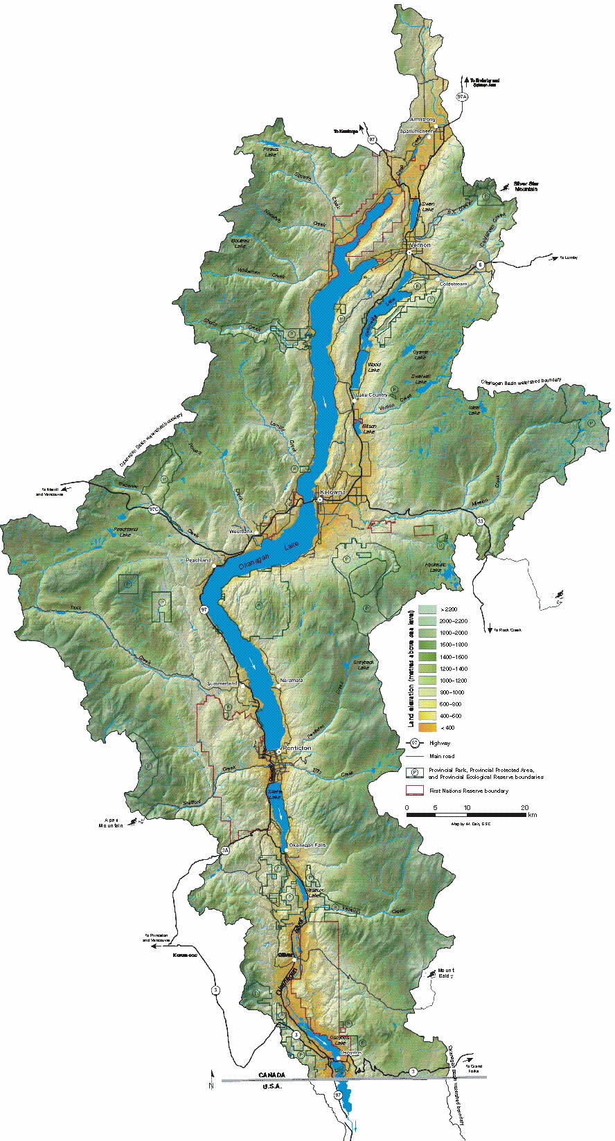
The Okanagan watershed, or basin, is a narrow strip that spans from Armstrong to the US border and includes six main lakes – Okanagan, Kalamalka, Wood, Skaha, Vaseux and Osoyoos – and surrounding mountains.
A river basin or watershed is high at its edges and low in the centre where the waters flow. The Okanagan Basin includes all the land that feeds water to our big lakes. Kelowna, Vernon, Penticton, and Osoyoos all lie within the Okanagan Basin.
The Okanagan Basin is almost 200 km in length and 8,000 km2 in area.
Where does water from the Okanagan Basin go?
The Okanagan River drains the lakes and flows south across the International Boundary as a small tributary to the Columbia River. Okanagan Basin water flows into the Columbia River, past the city of Portland, to the Pacific Ocean.
State of the Basin:
- Supply and demand in the Okanagan Basin was last assessed in 1974.
- Many streams are now fully allocated, and users are moving to groundwater.
- Increasing water licence requests underscore the need for a valley-wide approach to water management.
- Weather in the Okanagan Basin is arid and variable.
- The Okanagan has the lowest per person water supply in Canada.
- The average Okanagan resident uses 675 litres of water per day, more than double the Canadian average.
Related Links:
Read More:
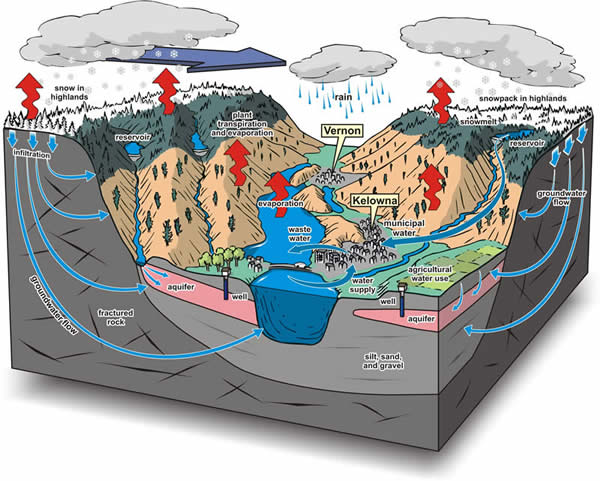
Okanagan Basin Water Cycle